Hi Blog,
Today was still the Chinese New Year festival, and I did not want to waste the chance to do anything over the weekend. As I was deciding where to go for a walk, K asked me to take him on an easy hike since he had never explored Singapore's hiking spots. After all, he always travels abroad. (To be honest, I wished I had such an opportunity to explore places)
 |
| Today's weather appeared gloomy, but still suitable for a walk. |
Since it's the New Year and K doesn't hike much, let's keep it easy. Ready to go!
|
| I had not worn my white trisuit in a long time, so I decided to restart my exploration while also bringing insta360 to places I had previously visited. |
 |
| To begin, I brought K to Lower Peirce after not seeing him in quite some time due to travel. |
 |
| I believe K had seen even more breathtaking scenery abroad than this, but he dismissed my thoughts. Haha... |
|
| Well, this fat blob only made the scenery worse; no wonder the weather was gloomy. |
 |
| On the way down, K told me how nice it was to get away from the city and closer to nature, and I could not agree more. |
|
| (Credit K) As an urban dweller, I cherish the moments when I can escape the cold, concrete surroundings and be part of nature, or simply be myself. |
 |
| Just some personal opinions as I explained about my hiking experience with K that there are many different types of hikes and that I have divided them into three categories based on difficulty and experience. |
-
Level 1: Near-Home – Parks and gardens with easy access to restrooms and shelters, offering a comfortable and accessible experience.
-
Level 2: Away from Buildings – Locations such as reservoirs and designated nature trails, where buildings are minimal or set far behind the natural landscape.
-
Level 3: Wild Wild Land – Untamed areas like urban exploration (Urbex) sites or off-trail locations, covered in dense, tall grass, with no clear paths, where getting lost is a real possibility.
 |
| So, beginners who are tired of and bored with level 1 can move on to level 2. |
|
Because Level 2 has three sub-levels based on distance:
- 2A is less than 5km
- 2B is less than 10km
- C is greater than 10km.
|
 |
| For example, today we will cover Lower Peirce and... |
 |
| ...Upper Peirce reservoir. |
 |
| Because the approximate distance covered exceeded 5 kilometres, this walk is classified as Level 2B, making it suitable for a good mix of experienced and non-experienced hikers. |
 |
Level 1 has sub-levels based on area size (for reference):
- 1A (less than 50 m²)
- 1B (50–250 m²)
- 1C (more than 250 m²)
|
 |
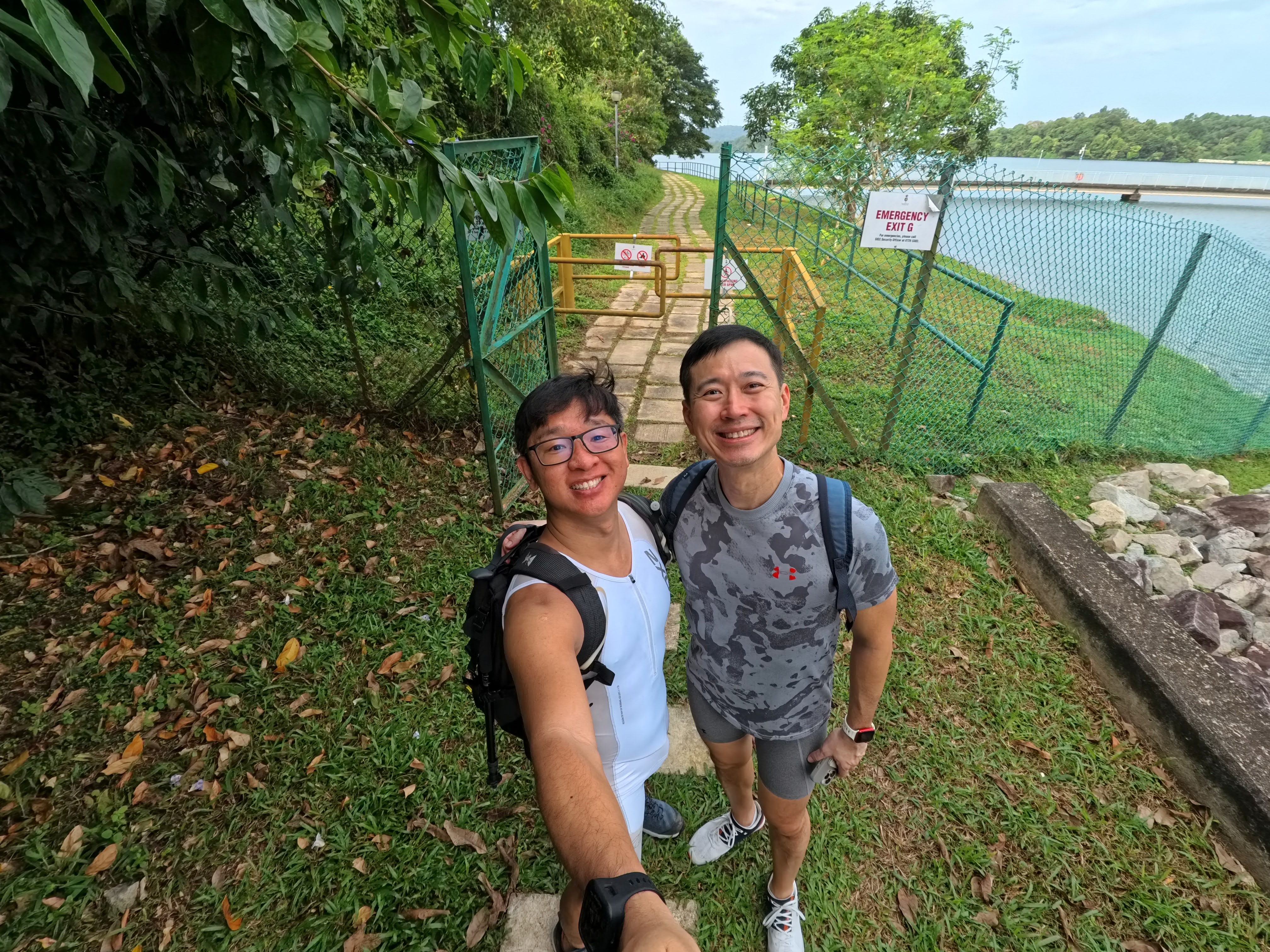
| Come on, K. Let's have a photo together. |
|
| I assumed my untoned and unusual attire made him feel awkward. Aside from the fact that K is good-looking, he would not want to associate with a weirdo like me. |
 |
| I think it's about time I give my drone a spin here. |
 |
| I love the perspectives it can capture! |
 |
| However, it appeared to be less sharp than I had expected... I suppose cheap drone quality is worth the price. |
 |
| It can take nice aerial shots, but the sharpness must be sacrificed, but it is worth a try. |
 |
| Good morning, Mr Sun. You finally emerge from the thick clouds. |
 |
| I guessed that the new path, also known as the Island Club road (which I visited in November 2024), would help to complete a loop for the walk today. |
|
| I hope it was not too long for K. He had walked at least 5km, so covering this path would take another 4 or 5km back to his car. |
 |
| He appeared to be fine, and I needed to get back quickly, so this was the best option. |
|
| After explaining to K how I measured different kinds of hiking trails, I felt that perhaps I should write it down and share it with anyone who might find it useful for gauging their hiking trip experience. Personally, mine only covers Singapore hiking trails and is completely useless overseas as it would be an entirely different consideration. |
Conclusion of My Personal Hiking Measurement System
Hiking comes in many forms, and people engage in it with different levels of experience and commitment. To track my personal hiking experiences, I’ve categorized hikes into three levels based on difficulty, accessibility, and terrain challenges.
===================================
Level 1: Urban Walks (Beginner-Friendly, Comfort Zone)
This level includes parks, gardens, and paved trails where amenities like restrooms and shelters are readily available. These areas provide a safe and comfortable environment, making them perfect for casual walkers or those just starting their hiking journey.
Sub-Levels (Based on Area Size & Distance)
- 1A – Small parks and walking paths (≤50 m²)
- 1B – Mid-sized parks and gardens (50–250 m²)
- 1C – Large parks and longer walking trails (>250 m², up to 5km)
💡 Once a hiker consistently reaches 5km, they may feel ready to explore beyond their comfort zone and transition to Level 2 hikes, which require more endurance and fewer conveniences.
===================================
Level 2: Nature Trails (Intermediate, Limited Accessibility)
These hikes take place in natural settings such as reservoirs, nature reserves, and designated trails. Unlike Level 1, these areas have minimal buildings and amenities like restrooms may be scarce. While some exits exist, they are often inconvenient, meaning hikers must be prepared to complete the full trail or take a longer way back.
Sub-Levels (Based on Distance)
- 2A – Short trails (≤5km)
- 2B – Moderate trails (5–10km)
- 2C – Long trails (>10km)
💡 At this stage, hikers must be more self-sufficient, managing hydration, endurance, and navigation while exploring more immersive natural landscapes.
===================================
Level 3: Wilderness Treks (Advanced, Off-Trail, Survival Skills Required)
This level involves hiking in untamed areas where trails are either unclear, overgrown, or nonexistent. It includes urban exploration (Urbex) sites, abandoned trails, and wild terrains with dense vegetation. Getting lost is a real possibility, requiring strong navigation skills, map reading, and adaptability.
Sub-Levels (Based on Terrain Difficulty)
- 3A – Semi-wild: Faint paths visible, occasionally used by hikers
- 3B – Bushwhacking required: Thick vegetation, no clear paths
- 3C – True off-trail: No signs of previous hikers, full navigation needed
💡 This level is for experienced hikers who enjoy the thrill of the unknown and the challenge of finding their own way through the wild.
===================================
Table Format of my Hiking Measurement System
| Level |
Type |
Description |
Sub-Level |
Criteria |
| 1 |
Urban Walks
(Beginner-Friendly, Comfort Zone) |
Parks, gardens, and paved trails with easy access to restrooms and shelters. Ideal for casual walkers. |
1A |
Small parks, walking paths (≤50 m²) |
| 1B |
Mid-sized parks, gardens (50–250 m²) |
| 1C |
Large parks, longer walking trails (>250 m², up to 5km) |
| 2 |
Nature Trails
(Intermediate, Limited Accessibility) |
Designated trails with fewer amenities, requiring endurance. Exits may be inconvenient. |
2A |
Short trails (≤5km) |
| 2B |
Moderate trails (5–10km) |
| 2C |
Long trails (>10km) |
| 3 |
Wilderness Treks
(Advanced, Off-Trail, Survival Skills Required) |
Unmarked or abandoned trails with thick vegetation. Navigation skills needed. |
3A |
Some visible paths from previous hikers |
| 3B |
Dense vegetation, bushwhacking required |
| 3C |
No visible paths, full navigation required |
===================================
Final Thoughts
This system helps me categorize my hikes based on difficulty, accessibility, and endurance. It also serves as a personal progression guide—moving from urban walks to nature trails and eventually to full wilderness treks.
Each level represents a different stage of hiking growth, helping me track my journey and challenge myself over time.
Would love to hear from fellow hikers—how do you measure your hiking experiences? 🚶♂️⛰️
Jeff


No comments:
Post a Comment
Take note that this blogspot doesn't have comment-notification alert, so if you have a question, please leave me your email so I can reply back.
if not, don't be shy to drop me your comment/feedback on my posts or follow my blog