Hi Blog,
What should I do on Saturday morning? Of course, go hiking! Let's go! There are numerous locations to revisit to refresh my memory.
 |
| Plus, today is July 5th, and there are rumours that a massive earthquake will occur near Japan. Personally, life is still going on. Hope for the best and prepare for the worst. |
Worrying will not help the day, but I was worried about it raining heavily. Let's see how. So, where shall I go?
|
| As the title implies, I recall seeing the path (from the opposite side of the Serangoon River) while cycling in the past and wondering about its accessibility. So I addressed my curiosity today. |
 |
| Here's a Google map of three forests: Buangkok Forest, Kampong Teban Forest, and Sungei Blukar. |
 |
| Wear a top to break up the look of a one-piece or to hide my fat... But it could not help because my double chin and round face said it all. |
 |
| When I arrived at the forest's starting point, I was shocked and concerned... I wondered if I was too late for an exploration before they turned this green into something else. |
 |
| I looked around and noticed that they had not covered everything, so I looked for an entrance, hoping they had not blocked it. Fortunately, they didn't! |
 |
| Nearby, there is a large parking lot reserved for large vehicles. |
 |
| I can get to the forest from here. |
|
| Alright! Henshin 変身! From a two-colour block to a single-colour block. No difference. |
 |
| Let's go! |
 |
| Started with Buangkok Forest. |
 |
| Buangkok Forest, located near Paya Lebar Airbase and Kampong Lorong Buangkok. |
 |
| There is only one direct route to it. |
 |
| A canal that connects with the Serangoon River is ahead. |
 |
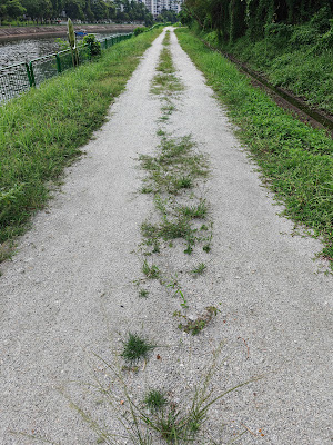
| Actually quite well maintained. |
 |
| The start of Buangkok Forest is here. Let's go and explore! |
|
| I am curious as to why the path has two rocky trails. Isn't it better to have the entire trail covered in rocks? We might find out the answer later. |
 |
| Canel continues; it will accompany me throughout the exploration. |
|
| It appeared that there was something inside this forest... I wish I could see it from above. |
 |
| Hmmm, something tells me that I can enter here. |
|
| An obvious trail was discovered, and I believe I will continue exploring. |
 |
| Hmm, some human activities are happening here to collect water. |
 |
| Oooo, we found an open space. It appeared that something had previously existed here. |
|
| It appeared that someone had previously maintained this space. |
 |
| Ooo, I spotted a makeshift tent with someone inside; I'd better not disturb them. |
|
| Back on the rocky path, there are pools; I imagine if there were no rocks, it would be muddy. |
 |
| Ooo, a group of NEA employees spotted me; were they trying to capture me for exploring this forest in disgusting attire? Nah, they warned me about a hornet nest in the bush, so I quickly moved away from it. |
 |
| We arrived at the area where the Serangoon River flows. |
 |
| Whoever stays here will enjoy an unobstructed view of greenery, but this river canal is man-made... Oh well, do not complain too much. |
 |
| I understand the purpose of these two rocky trails, especially since the area could have softer ground, resulting in pooling after rain and muddy ground for potential mosquito breeding sites. |
 |
| Buangkok Forest is a relatively young secondary forest surrounded by scrubland and freshwater marshes. |
 |
| Utility boxes and equipment are common in Singapore's water catchment areas, used primarily for water resource management and distribution. Utility Boxes: The green and grey boxes are most likely electrical or control panels for water management systems, which could include equipment for monitoring water levels, flow, or pump operation. Singapore relies heavily on water catchments to collect rainwater, which is then treated and distributed for drinking. The equipment shown is part of the infrastructure that supports this system. Thank you, Google, for providing me with an explanation. |
 |
| Knowing this, I cannot imagine how it works beyond what I can see or visualise; I hope to learn more about it. |
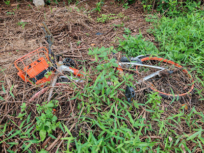 |
| Ooo, have you ever seen an image of a body on Mount Everest? There is a bicycle body in the forest. |
 |
| I just mentioned that Buangkok Forest is a young secondary forest; I came across the term "secondary" forests online and was curious what it meant. |
|
| According to what I have read, primary forests are typically biodiversity-rich with no human disturbances. Meanwhile, secondary forests are regenerating after human disturbance, with fewer plant and animal species. In contrast to the past, Buangkok Forest now supports a variety of birds, including parakeets, dragonflies, damselflies, and butterflies. |
|
| So this forest has recovered from the damage and moved away from its previous image. Will I be able to recover from previous damage? I must admit that the secondary me may not be perfect, and I am not at the start; am I okay? Am I accepted? It does not matter; what matters is that I keep moving forward. |
 |
| Anyway, I noticed there is a fence around and... |
 |
| There is a right-turn path into the forest, but I could not see it. |
 |
| I climbed up to a zone without a fence and noticed thick vegetation. I think I will stay away from it. |
 |
| It appeared that I did not have access to the forest as shown on the map, and I came to the end of the trail through Buangkok Forest. |
 |
At least, I attempted to enter earlier to locate the makeshift tent.
|
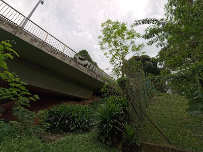 |
| The two forests are separated by an expressway. |
 |
| To be honest, it is the ideal shelter for some situations. |
 |
| Next place - Kampong Teban Forest. I could not find any information about this forest online. I did read somewhere about |
 |
| Next, landscapers arrived to maintain the trail; no wonder the area is well-kept. |
 |
| They are here to keep the vegetation in place and the water utilities visible among the tall grass. |
 |
| Kampong Teban Forest differs from Buangkok Forest in that it appears wilder and more densely vegetated. |
 |
| The forest side was fenced off throughout, as if there was something inside. |
 |
| You do not get to see the Serangoon River or the estates on our left. |
 |
| The water utility resembles a tomb in the Kampong Teban forest, and one will be found every 50 metres. |
 |
| Some tree falls can be seen here, as if attempting to escape from this space. |
 |
| Oops... It sounded like rain was coming towards me. |
|
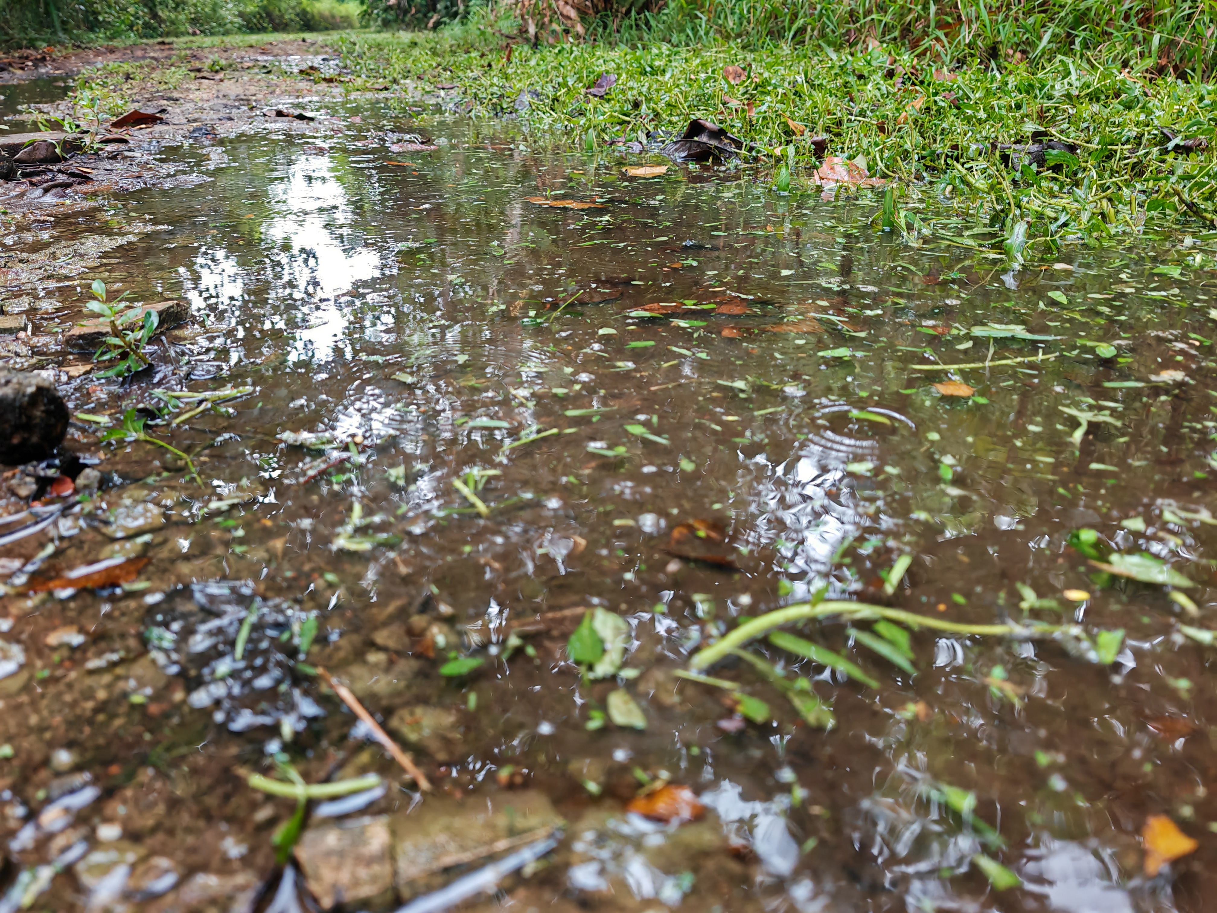
| There are numerous pooling scenarios, and if you do not wear proper shoes, like my Decathlon water-resistant shoes, be prepared to have wet socks. |
 |
| Previously, Buangkok Forest was rocky and muddy, but now it appears raw and grassy. Oh yeah... The rain also started... |
 |
| Should I go back and exit? But I was halfway done and still had one more forest to cover... |
|
| Anyway, I should not turn back and finish the forest. |
 |
| Oooo, a fallen tree! Is it a sign to ask me to enter? |
 |
| But the muddy ground appeared unwelcoming. Haha... |
|
| They will soon outgrow the fence. |
 |
| When I came across a flyover, I knew I was near the end of Kampong Teban Forest. |
 |
| Was the lessening of rain a sign that I should continue or stop? |
 |
| I saw this trail... It seemed welcoming... Should I? Actually, I should not, as I don't have enough time to explore. |
 |
| But I saw a normal trail beside; maybe I should check it out first. |
|
| Oh, great! The rain had stopped! |
 |
| Let us see where this leads me. |
 |
| Many vehicles fly above me; I imagine myself in a vehicle, unaware of what lies beneath me. |
 |
| Oooo! An entrance to a water utility. |
|
| It appeared to be locked and that there might be a road within Kampong Teban Forest... But it was locked, so I could not access it. |
 |
| Hmmm, let us turn back because the rain seemed to be returning. |
|
| It would be fun if I did not have to carry my bag and other handheld items, such as my phone, and could just wear my trisuit while it rained. |
 |
| Okay, that is it for the Kampong Teban Forest, the next forest. |
 |
| Will I have a place where I can see water and greenery? Yes, in my dream! :D |
 |
| The last forest is Sungei Blukar Forest. |
 |
| It looks like a large plot of land with little inside. |
 |
| Rocky ground before... |
 |
| I was about to confront the muddy ground again. |
 |
| A lorry passed me and left a solid mud trail. |
|
| The water utility in Sungei Blukar Forest is quite unique; unlike the other two forests, it is built higher up on the slope. |
 |
| It appears to be an interesting setting for a drama. |
 |
| According to what I read online, Sungei Blukar Forest was once a trash dump about 30 years ago but has since transformed into a secondary forest, which is incredible! |
|
| There are many muddy grounds here, and they are quite soft and deep. |
 |
| Be prepared to walk in dirty shoes, but I am fine with it because I tried to walk somewhere. |
 |
| Finally, I arrived at a more settled grassy area, and Mr Sun came out to dry my wet clothing. |
|
| I found a bridge that connects to the expressway, Pasir Ris Industrial Drive 1, and I believe it is time to return to meet a buyer. |
 |
| I think I will return to cover the remaining two areas here - Lorong Halus Landfill. |
|
| Sunny afternoon. It is funny how quickly the weather changed from cloudy to rainy to sunny. At least I finished all three forests for the day! |
Overall, the three forests along the Serangoon River - Buangkok Forest, Kampong Teban Forest, and Sungei Blukar Forest - provide opportunities for reflection and rejuvenation on hiking trails. Nothing more than muddy ground and lush greenery. I will return to explore Kampong Teban and the landfill areas as soon as I am available.
Jeff


Have a good day Jeff 🔥🔥🔥✨
ReplyDelete